
A Short but Educational Map Tour of the Texas Republic in the 1840s
- Robin Cole-Jett

- Dec 27, 2025
- 4 min read

Texas is a whole 'nother country, as people who live in Texas like to point out. And from 1836 to 1845, it actually was. But how big this other country was, when it went by the Republic of Texas, is a whole 'nother matter. The map collectors and dealers at Barry Lawrence Ruderman's Rare Maps offer a real smorgasbord of these vantage points, which I curated over here at Red River Historian to provide some simplified context.
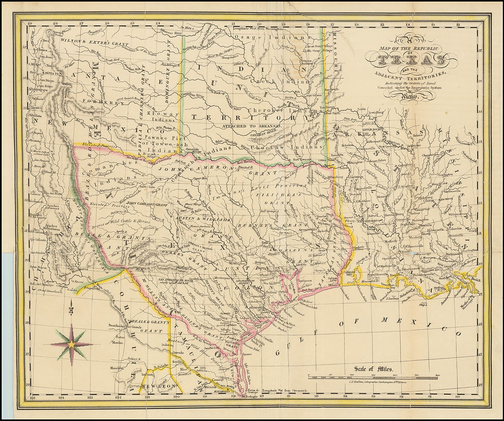
Mexico, for example, believed Texas to be only as large as the eastern lands that Anglo Americans occupied through their Empressario system. The US-migrant reach only extended southward to the Nueces River and didn't go very far to the west.
When Texas was a Republic, the British Empire contemplated establishing cotton trade with Texas to circumvent having to deal with the United States. At the same time, they also were investing heavily in the industrialization of Mexico, so they did not officially take sides in the Mexican-American War (1846 to 1848) and accepted the viewpoints of the victors.
The French and Germans (particularly the Alsatians) depicted Texas not through a political lens but rather focused on the practicalities of immigration. They wanted to know the locations of good sources of water as well as where the aboriginal people claimed their territories in an attempt to avoid potential warfare and to compensate tribes for the takeover. In particular, the French appeared to maintain their vintage viewpoints of the areas that bordered the Louisiana Territory. Their maps reflect what the French knew of Texas prior to 1803.
Like the European immigrants, the United States saw Texas's farming potential, but like the British, it also viewed Texas as an important industrial investment. This is why the preferred viewpoint of Texas's size took on the proportions proffered by the OG of North America's mapmakers, the Scotsman John Arrowsmith. He drew the Republic's boundaries encompassing the lands between the Red River, Rio Grande, and extending into New Mexico, and denoted which areas were good, better, and best for settlement and development.
Maps are great snapshots of contemporary viewpoints that depict past, present, and potential futures, and this is definitely true for maps that depict the Republic of Texas. When examining them closely, a reader can really visualize how they informed the history of this U.S. state. Thank you, Barry Lawrence Ruderman, for sharing these maps with us!


Comments